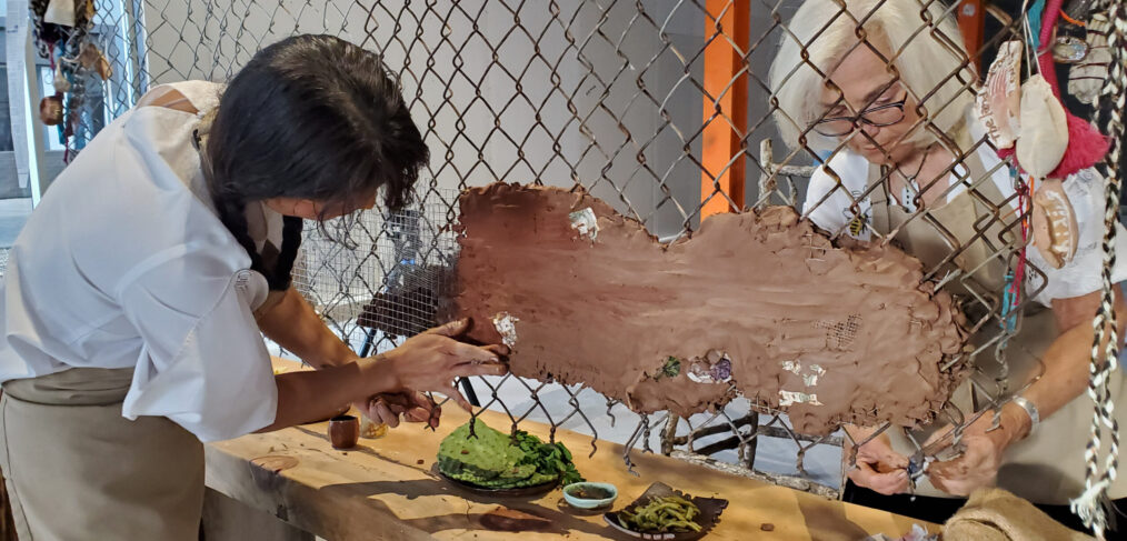
Inside a 35,000 square foot raw warehouse space built in the 1950’s in downtown Phoenix, AZ, two artists embarked upon a major mixed media art installation-performance piece. The purpose was to bring awareness to issues around immigration reform, social justice, and behaviors that inspire and create lasting change that benefit and sustain life for all.
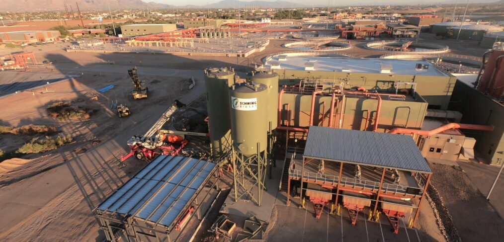
The Tres Rios Wastewater Reclamation Facility (WRF) is the centralized biosolids processing facility for Pima County. The Nutrient Recovery Project at the Tres Rios WRF facilitated the capture of energy and nutrients in addition to cleaning wastewater. The project is the first installation of the NuReSys system in North America, making the Tres Rios WRF an industry leader in the management and sustainability of the water reclamation cycle and other renewable resources.
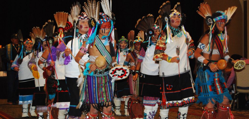
Throughout history, Native American communities have held a special relationship with the animals, particularly birds and their feathers. Feathers are present in the celebration of birth, the passage to man and womanhood, the healing of the sick and the recognition of death – the cycle of life. Liberty Wildlife is a conservation non-profit and the only organization permitted by the U.S. Fish and Wildlife Service to accept, hold, and distribute non-eagle feathers to Native Americans for religious and ceremonial purposes. For every feather sent out, one less feather will be purchased on the black market, and one less bird taken from the wild.
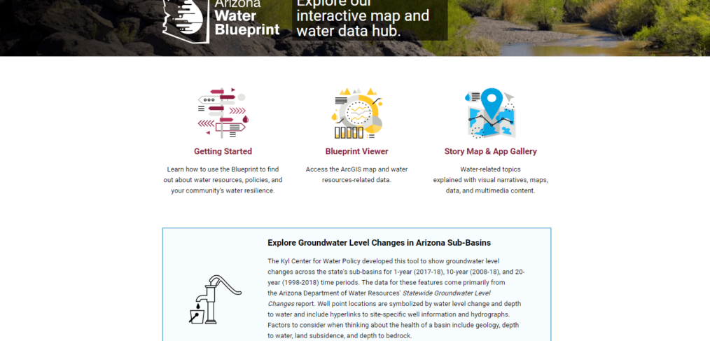
The Arizona Water Blueprint addresses Arizonans’ need for comprehensible, accurate, non-partisan and detailed information about Arizona water resources and policy, empowering inclusive and informed decision-making about the state’s water future. The heart of the Blueprint is an interactive map comprising 56 discrete data layers. A user can easily explore Arizona’s water resources and infrastructure, download data specific to a particular geography, and visualize how different features and datasets are related. Because it offers unique opportunities to visualize and compare data and geospatial information, the Blueprint is being used in local and statewide planning discussions as well as in high school and university classrooms.
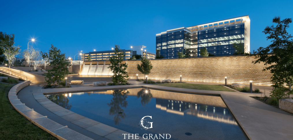
The Roosevelt Dam Feature and the Grand Canal Relocation and Multi-Use Path, each part of The Grand at Papago Park Center mixed-use development, were designed to celebrate and pay homage to two of the most important infrastructure projects in Arizona: the Roosevelt Dam and the Grand Canal. The projects demonstrate an awareness of sustainability and inspires solutions with minimal water use. The Grand at Papago Park Center establishes a model that can be replicated by other communities for improvements along the Valley’s canal system.
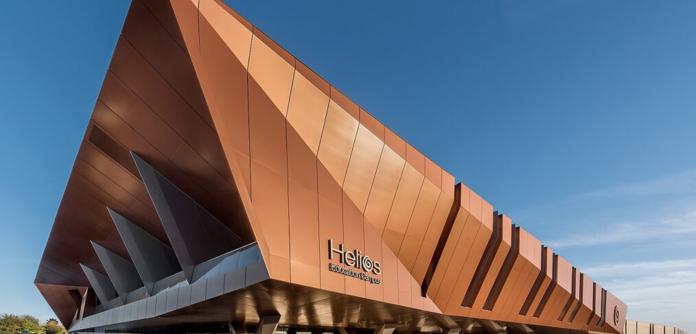
The new campus is a collaborative creative place to promote, discuss, and debate reforms to and the advancement of postsecondary education with the Helios Foundation, their strategic partners and policy makers locally and nationally. Sustainability features include the use of multiple non-potable water sources including site captured water for the landscape and a super insulated envelope & radiant cooling system to reduce energy use. The Campus is a contemporary revisioning of the arid-responsive garden office, built to last for generations.
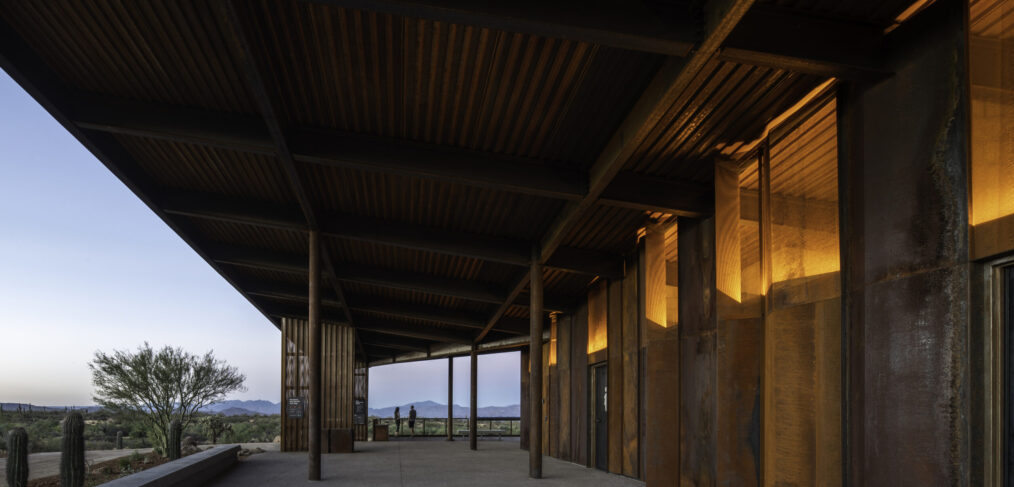
The Fraesfield and Granite Mountain Trailheads, part of Scottsdale’s McDowell Sonoran Preserve, were disturbed trailhead sites in need of restoration. Two complementary yet contrasting designs highlight the unique characteristics of each respective sites. The trailheads restored the natural habitat while expanding and facilitating access into the McDowell Sonoran Preserve, allowing the natural environment to guide the design of sustainable amenities that provide refuge, shade and shelter.
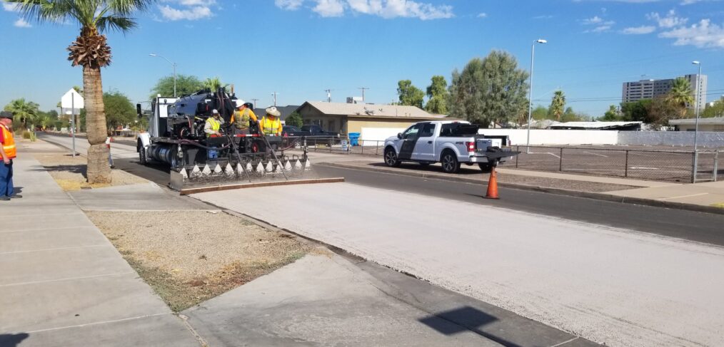
Addressing the urban heat island, a quality-of-life issue in a desert environment, was key to the development of the City of Phoenix’s Cool Pavement Pilot Program. During the summer of 2020, Phoenix completed a project by installing an innovative asphalt seal coat technology that could provide meaningful relief from the urban heat island affect. This technology first tried by the City of Los Angeles, CA, reflects solar energy and reduces the daytime pavement surface temperature. The pilot resulted in 36 miles of Cool Pavement treatment in eight neighborhoods and one city park; all with the potential to improve comfort and livability in Phoenix.
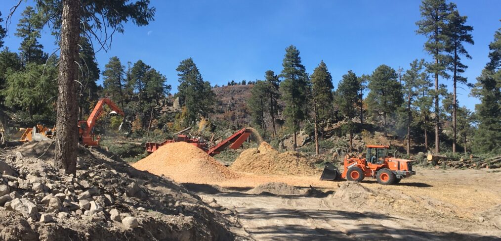
In 2017, the Coconino County Board of Supervisors identified catastrophic wildfires and post wildfire flooding as the number one public safety risk for the citizens and the environment in Coconino County. As a results, the Coconino County Flood Control District (FCD) developed a county-wide Forest Restoration Initiative in response to the devastating impacts of catastrophic wildfires and post-wildfire flooding, protecting the forests and economic vitality of northern Arizona, safety of all citizens. The initiative can be a state-wide model of collaborative, forward-thinking policy in action.